![]()
Questions that this tool can answer:
- Where in my state have soil health practices been most widely adopted? Which areas are lagging?
- Where would implementation of conservation agriculture practices provide the most carbon benefit at the lowest cost?
- What percentage of land in my state must adopt conservation agriculture practices to meet our climate goals?
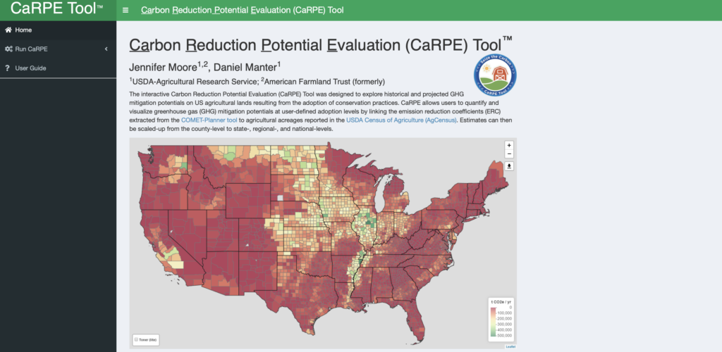
The Carbon Reduction Potential Evaluation Tool™, or CaRPE Tool, is a web-based interactive tool developed by the American Farmland Trust and the U.S. Department of Agriculture that allows users to quickly visualize and quantify greenhouse gas (GHG) emission reductions resulting from the implementation of a suite of cropland and grazing land conservation management practices.
The tool provides a mechanism to quickly compare practices, their estimated costs, and where the greatest impact can be achieved across a state or region. The tool’s data and maps help policymakers, soil and water conservation district planners, land managers, conservation agencies and NGOs optimize climate benefits from agricultural management.
With this tool, you can map current acres and percent of cover crops and conservation tillage at county scale, estimate (and map) GHG reduction potential from current adoption levels, run scenarios for future GHG benefits from additional acres implementing practices, estimate implementation costs, and generate maps and tabular data summarized for each scenario and scaled to county, state, regional, or national levels.
Additional Resources
- This article on AFT’s website describes how users can use the CaRPE tool to visualize and quantify the emissions reductions resulting from the implementation of climate-smart agricultural practices.
- This Illinois case study shows how the CaRPE tool is helping Illinois farmers and decisionmakers identify opportunities for sequestering carbon on agricultural land, while highlighting the benefits of these strategies.