![]()
Questions that this tool can answer:
- Where are farms in a state facing the most pressure from development? What lands should local governments, land trusts and other organizations target for protection?
- Which policy mechanisms present the biggest unrealized opportunity in my state? What are examples of programs in other states that can be applied to my state?
- How can state and local governments work together to keep farmland intact?
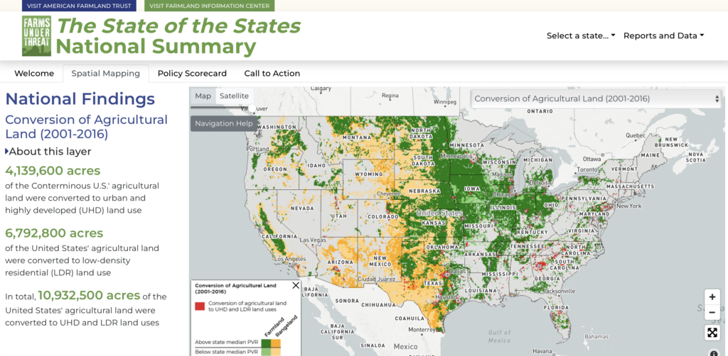
From 2001-2016, 11 million acres of agricultural land were paved over, fragmented, or converted to uses that jeopardize agriculture, curtailing sustainable food production, economic opportunities, and the environmental benefits afforded by well-managed farmland and ranchland. Adoption of climate-smart agricultural practices on farmland represent an important opportunity to remove and store carbon, and the conversion of these lands to development represents a lost opportunity to address climate change.
Compounding these impacts, 4.4 million acres of Nationally Significant land were converted to developed land uses – an area nearly the size of New Jersey. The Nationally Significant farmland designation developed by the American Farmland Trust identifies the most productive, versatile, and resilient land for sustainable food and crop production.
The spatial mapping tool developed by American Farmland Trust highlights the scale of conversion of agricultural land to developed land uses, and where conversion is most prevalent. The Agricultural Land Protection Scorecard assesses state-level action to address farmland loss, measures their performance, and highlights policy actions in each state that have been effective in addressing the problem. Policy tools assessed on the scorecard include agricultural easement programs, land-use planning policies, property tax relief for agricultural land, agricultural district programs, state leasing programs and Farm Link programs that link land seekers with landowners who want their land to stay in agriculture.
Additional Resources

