![]()
Questions that this tool can answer:
- How can communities integrate trees and forest into their Climate Action Plans?
- How can communities track the annual greenhouse gas impacts associated with changes to forests and tree cover over time?
Many communities in the U.S. are developing Climate Action Plans to reduce greenhouse gas emissions and achieve carbon neutrality. While many of these plans focus on the energy, transportation and waste sectors, most do not consider the role forests and trees play in the fight against climate change. This is because planners have lacked the data and clear guidance needed to include them in greenhouse gas inventories, which Climate Action Plans are based. Forests and trees play a critical role in carbon sequestration while providing other benefits to communities, including improved air quality, reduced energy costs, and increased well-being. Accurately monitoring these resources over time may enable communities to make better land management decisions that benefit both climate and people.
To help communities incorporate trees and forests into their Climate Action Plans, experts from WRI, ICLEI – Local Governments for Sustainability (ICLEI USA) and the Woodwell Climate Research Center published guidance for ICLEI USA’s U.S. Community Protocol as well as the Global Protocol for Community-Scale Greenhouse Gas Emission Inventories – frameworks that outline how to estimate emissions caused by forest and tree cover loss within communities, as well as carbon absorbed by forests and trees that a community maintains and plants. The accompanying Land Emissions and Removals Navigator (LEARN) tool helps communities implement this guidance and integrate estimates into their greenhouse gas inventories.
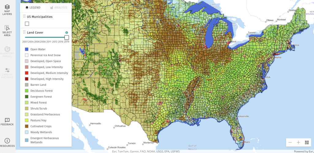
LEARN is a free online tool that combines methods outlined in the U.S. Community Protocol with the data necessary to perform the calculations. In just a few clicks, users can derive locally-tailored estimates of the annual greenhouse gas impacts associated with changes to forests and tree cover in their community over time. After users specify an area and years to analyze, LEARN performs automated, spatially explicit analyses of data from the U.S. Forest Service and U.S. Geological Survey, including land cover change, type and age structure of a community’s forest lands, timing and location of forest disturbances (fire, harvest, and insect outbreaks), as well as loss and gain of tree canopy cover in urban and other non-forested lands.
Nationally, the LEARN tool performs analysis based on the NLCD Tree Canopy data. While this dataset provides national coverage, it does not accurately capture the true extent and change of trees in many highly urbanized communities due to its relatively coarse (30 meter) spatial resolution. In early 2022, the LEARN project team collaborated with the Chesapeake Conservancy to update LEARN, which now includes high resolution (1 meter) tree canopy change maps for six eastern states and the District of Columbia, derived from the Chesapeake Bay program 1 meter land cover/land use data. The resulting 900-fold increase in resolution enables counties and cities along the eastern seaboard to analyze tree canopy change down to the scale of individual land parcels. This update not only demonstrates the benefits of significantly enhanced analysis capabilities, but it reinforces calls to extend this dataset from regional to national coverage.