![]()
Questions this tool can answer:
- Identifying opportunities for tidal marsh restoration and conservation, providing a blueprint for state and local governments, non-profits, and other entities to target their efforts.
- Establishing a baseline for measuring the impact of future tidal marsh conservation and restoration efforts, allowing governments to build more effective tidal marsh protection and restoration into their climate mitigation and adaptation strategies.
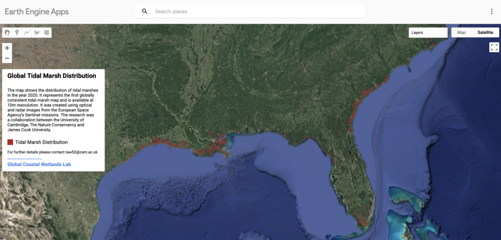
In June 2023, researchers at The University of Cambridge and The Nature Conservancy (TNC) published the Tidal Wetlands Mapper, the first globally consistent 10m resolution map of Earth’s tidal marshes. These often underappreciated yet highly productive coastal ecosystems are critical contributors to human wellbeing, climate, and biodiversity. This map allows for a better understanding of the extent of tidal marsh habitat, helping to identify opportunities for conservation and restoration.
Tidal marshes – which are predominantly salt marshes, but include some freshwater marshes – are supercharged ‘blue carbon’ ecosystems found across cool, temperate and some tropical regions that play a similar ecological role to that of mangroves. The marshes store carbon in their soils for millennia, making them crucial contributors to climate change mitigation efforts, while also supporting countless plant species and providing feeding and nesting grounds for billions of birds, fish, mollusks, and crustaceans.
The global map highlights the Atlantic shores of North America and Northern Europe as global tidal marsh epicenters – home to 45% of the world’s tidal marshes. Their location on rich, low-lying land adjacent to waterways (often some of the world’s most populated areas) means tidal marshes have long been cleared and drained for agriculture, industry, transport networks and urban expansion. So much tidal marsh area has been degraded or drained that these ecosystems are now rare – covering only 53,000 km2 of land across the globe – less than the size of West Virginia.
The researchers behind the new tidal marsh map hope that local conservation initiatives, like the Lightning Point Shoreline Restoration Project recently profiled by U.S. Nature4Climate, can provide powerful blueprints for action, while the global map can encourage a vast scaling up of conservation, enabling communities the world over to benefit from tidal marsh conservation and restoration.
The Nature Conservancy and partners at the University of Cambridge and the University of Delft are already working on several associated initiatives, including a global model of carbon storage in tidal marshes that will be applied to the existing map, as well as a global model of the importance of tidal marshes in protecting people and infrastructure from storm surges and flooding.