![]()
Questions that this tool can answer:
- Where are existing forest carbon stocks and areas with high annual carbon sequestration rates?
- What and where are the threats to these carbon-rich landscapes from development, insects and disease, and wildfire risk?
- Where can climate conservation also provide multiple co-benefits by protecting drinking water supplies, rare ecosystems, and important habitat cores?
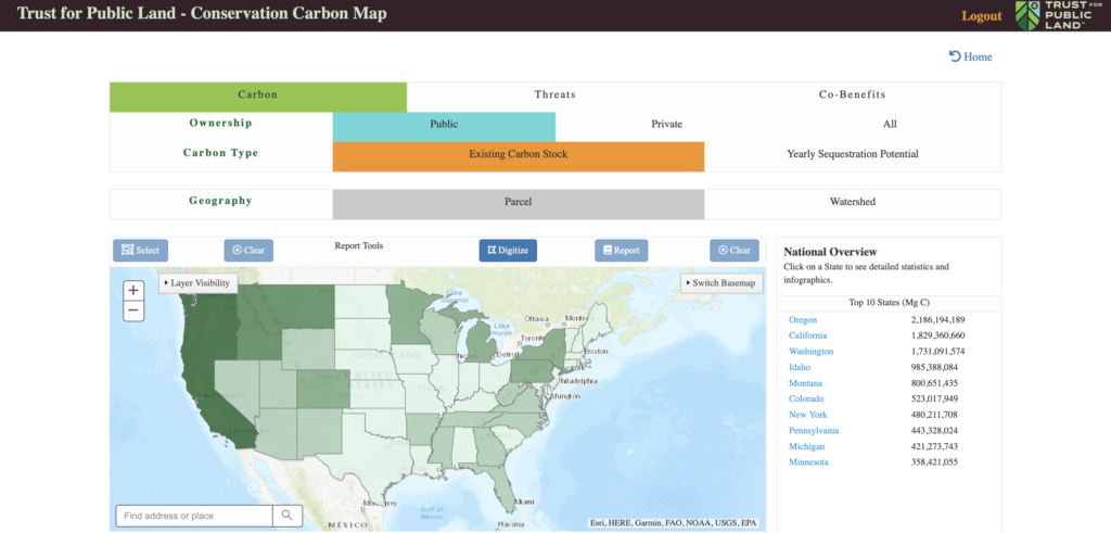
As climate change impacts intensify around the world, nature-based carbon sequestration and storage are essential tools to addressing the climate crisis. In fact, research has shown that cost-effective natural climate solutions in the U.S. have the potential to absorb 21% of our current net annual greenhouse gas emissions. The question remains, however, where to focus conservation in order to maximize climate benefits. The Conservation Carbon Map, produced by Trust for Public Land with funding from the Royal Bank of Canada Tech for Nature program, can help answer that question and more.
This tool helps identify existing forest carbon stocks and areas with high annual carbon sequestration rates, as well as threats to these landscapes from development, insects, disease, and wildfire. The Conservation Carbon Map also illustrates where climate conservation projects can provide co-benefits, like habitat protection and water quality protection. Data is summarized at the state, county, and watershed scale as well as for approximately 3 million parcels across the U.S that are larger than 100 acres.
Users of the tool can create their own custom analysis by drawing a polygon around an area of interest, providing the flexibility to analyze carbon sequestration potential, threats, and co-benefits data for a couple parcels, a neighborhood or an entire mountain range. Carbon data is presented as a color gradient to allow users to quickly identify areas that have the highest amount of carbon (or least amount of carbon).