![]()
![]()
![]()
Questions that this tool can answer:
- What Natural Climate Solution Strategies have the most potential in my state? How can we structure our state’s Natural & Working Lands climate program to account for these opportunities?
- How should incentive programs be structured to leverage these opportunities? Market-based approaches? Grant programs?
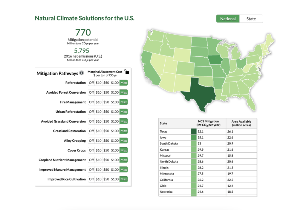
The U.S. Natural Climate Solutions Mapper illustrates the greenhouse gas mitigation impact of 11 Natural Climate Solutions pathways that can be adopted on agricultural, forested, and urban lands, with data broken down at the state level.
The mapper’s data estimates the amount of carbon that can be sequestered by each of the 11 pathways. It estimates not only the maximum potential, but also the amount of mitigation that would be achieved with different levels of carbon payments, at three different carbon prices. The higher the carbon payment, the more the adoption of new practices is incentivized, leading to greater benefits for the climate. The tool illustrates the benefits can be achieved while still maintaining current croplands and developed areas.
The mapper can serve as a powerful resource for state-level decision-makers to identify which Natural Climate Solution practices offer the most efficient pathways for carbon reductions in their state. It was designed to help inform states’ plans and strategies for facilitating the adoption of nature-based climate solutions strategies.