![]()
![]()
Questions that this tool can answer:
- Where should my municipality, agency or land trust focus our conservation efforts for maximum climate and biodiversity benefit?
- How can I identify what forests in my area have the greatest potential to capture carbon dioxide and fight climate change?
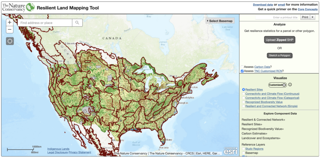
The Nature Conservancy’s Resilient Lands Mapping Tool allows agencies, land trusts, communities, and others to identify resilient lands across the United States where plant and animal species have the best chance to move away from growing climate threats and find new places to call home.
The tool was developed using data gathered by more than 150 scientists over 10 years that identifies a network of landscapes across the United States with unique topographies, geologies, and other characteristics that can help withstand climate impacts.
The mapping tool can bring together government agencies, land trusts, businesses, private landowners, Indigenous communities, local leaders, and others to develop conservation plans that will help nature thrive on a national scale and continue to provide clean drinking water, economic opportunities and other important services people rely upon for survival.
The tool also allows land managers and other decision-makers to calculate the potential of forests across the continental US to capture and store climate-changing carbon emissions for decades to come, even on lands as small as one-quarter of an acre.
Local, state, and federal decision-makers across the country are using the tool to help them prioritize conservation action, develop effective conservation plans, improve greenhouse gas accounting, and calculate how forest conservation compares to other, sometimes more costly, means of removing and reducing carbon emissions. In regions with increased disturbances, such as fire, the information may be used to inform forest management strategies that reduce the risk of carbon losses.
For example, in North Carolina, the mapping tool was used by the Sandhills Conservation Partnership – a collaboration between the US Fish and Wildlife Service, the North Carolina Forest Service, Fort Bragg, The Nature Conservancy and others – to expand their area of work to include the Uwharrie Mountains. Many longleaf-associated species such as the red-cockaded woodpecker have disappeared from the Uwharries due to a lack of fire management, but the roadmap identified the area as being highly resilient due to its varying soils and topography. The Partnership decided to expand their conservation work to include the Uwharries to ensure it could provide safe homes to the Sandhills’ wide diversity of species as they migrate away from climate impacts.
The Nature Conservancy is also sharing the mapping tool with solar companies to help them determine the best places to site development without harming these important lands.
Additional Resources
- This article explains how decision makers can use the carbon layer recently added to the Resilient Lands Tool to target specific areas for conservation that have both value for biodiversity and for carbon storage.
- This article illustrates how the Resilient Lands Mapping tool was used to identify a network of resilient and connected lands that can serve as “natural highways and neighborhoods” for plant and animal species to resist the growing threats posed by climate change.
- This story map highlights climate-resilient sites across the continental US that collectively represent the extraordinary natural diversity of the country.