Many communities in the U.S. are developing Climate Action Plans (CAPs) to reduce greenhouse gas (GHG) emissions and achieve carbon neutrality. While many CAPs focus on the energy, transportation and waste sectors, most do not consider the role forests and trees play in the fight against climate change. This is because planners have lacked the data and clear guidance needed to include them in GHG inventories, which CAPs are based.
To address this gap, experts from WRI, ICLEI – Local Governments for Sustainability (ICLEI USA) and the Woodwell Climate Research Center published guidance for ICLEI USA’s U.S. Community Protocol as well as the Global Protocol for Community-Scale Greenhouse Gas Emission Inventories.
These frameworks outline how to estimate emissions caused by forest and tree cover loss within communities, as well as carbon absorbed by forests and trees that a community maintains and plants.
The accompanying Land Emissions and Removals Navigator (LEARN) tool, developed in collaboration with web developer Blue Raster, makes it even easier for communities to implement this guidance and integrate estimates into their GHG inventories.
What is LEARN?
LEARN is a free online calculation tool that combines methods outlined in the U.S. Community Protocol with the data necessary to perform the calculations. In just a few clicks, users can derive locally tailored estimates of the annual GHG impacts associated with changes to forests and tree cover in their community over time.
After specifying an area and years to analyze, LEARN does the rest by performing automated, spatially explicit analyses of data from the U.S. Forest Service and U.S. Geological Survey, including:
- Land cover change
- Type and age structure of a communitys forest lands
- Timing and location of forest disturbances like fire, harvest and insect outbreaks
- Loss and gain of tree canopy cover in urban and other non-forested lands
(Read more about the history and development of the LEARN tool.)
What’s new with LEARN in 2022?
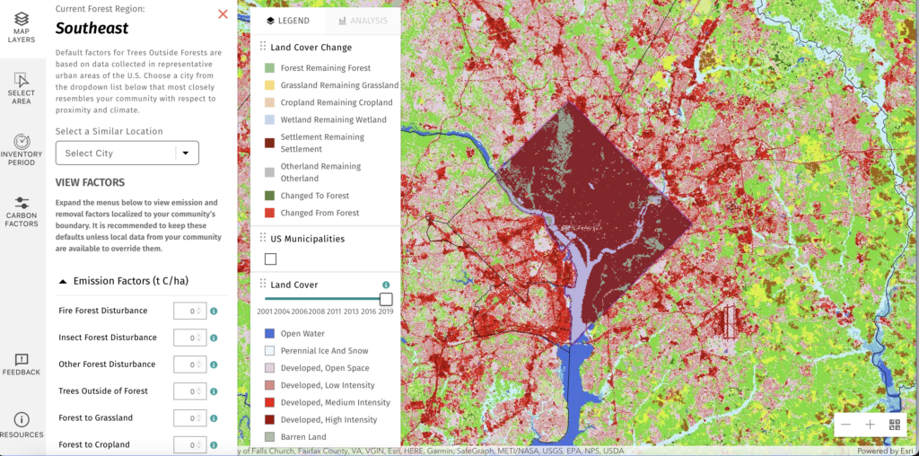
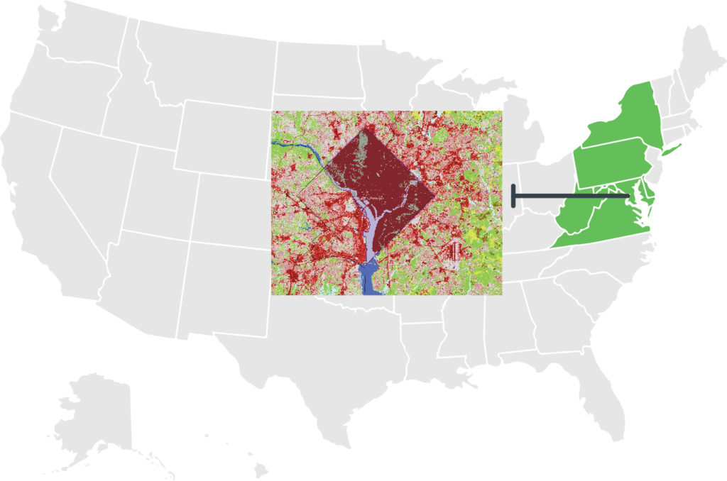
In early 2022, the LEARN project team collaborated with the Chesapeake Conservancy to implement a suite of updates to LEARN. Beyond land cover change and forest disturbance data updated through the year 2019, LEARN now includes high resolution (1 meter) tree canopy change maps for the Chesapeake Bay watershed derived from the Chesapeake Bay program 1 meter land cover/land use data. These maps span across six eastern states and the District of Columbia and support communities of more than 18 million people.
Previously, the LEARN tool performed analysis only on the NLCD Tree Canopy product. While this dataset provides national coverage, it fails to accurately capture the true extent and change of trees in many highly urbanized communities due to its relatively coarse (30 meter) spatial resolution. Now, counties and cities along the eastern seaboard can view the new high-resolution tree canopy data in 900 -times more detail than before and analyze tree canopy change down to the scale of individual land parcels. This update not only demonstrates the benefits of significantly enhanced analysis capabilities, it reinforces calls to extend this dataset from regional to national coverage.
In July 2022, the project team launched a second training cohort to guide 20 communities in implementing the U.S. Community Protocol methods and using the LEARN tool. This followed a first successful Forests & Trees Carbon Accounting Cohort Training Session in 2021. Participants in the second cohort included municipal governments, tribes and states both within the Chesapeake watershed and across the country.
Next Steps for Community GHG Inventories: Scaling and Impact
The successful launch of the U.S. Community Protocol and LEARN tool spurred the creation of a new internationally applicable protocol for estimating GHG impacts of forests and trees at the local scale. The Global Protocol for Community-Scale Greenhouse Gas Inventories Supplemental Guidance for Forests and Trees launched in July 2022. The protocol has already been successfully piloted in Jakarta, Mumbai, Salvador and Mexico City, and many more cities and communities across the world plan to incorporate the methods into their emissions inventories. ICLEI USA is also expanding the U.S. Community Protocol with a steering committee to spearhead a more accessible and holistic approach for local and regional governments to view and manage emissions.
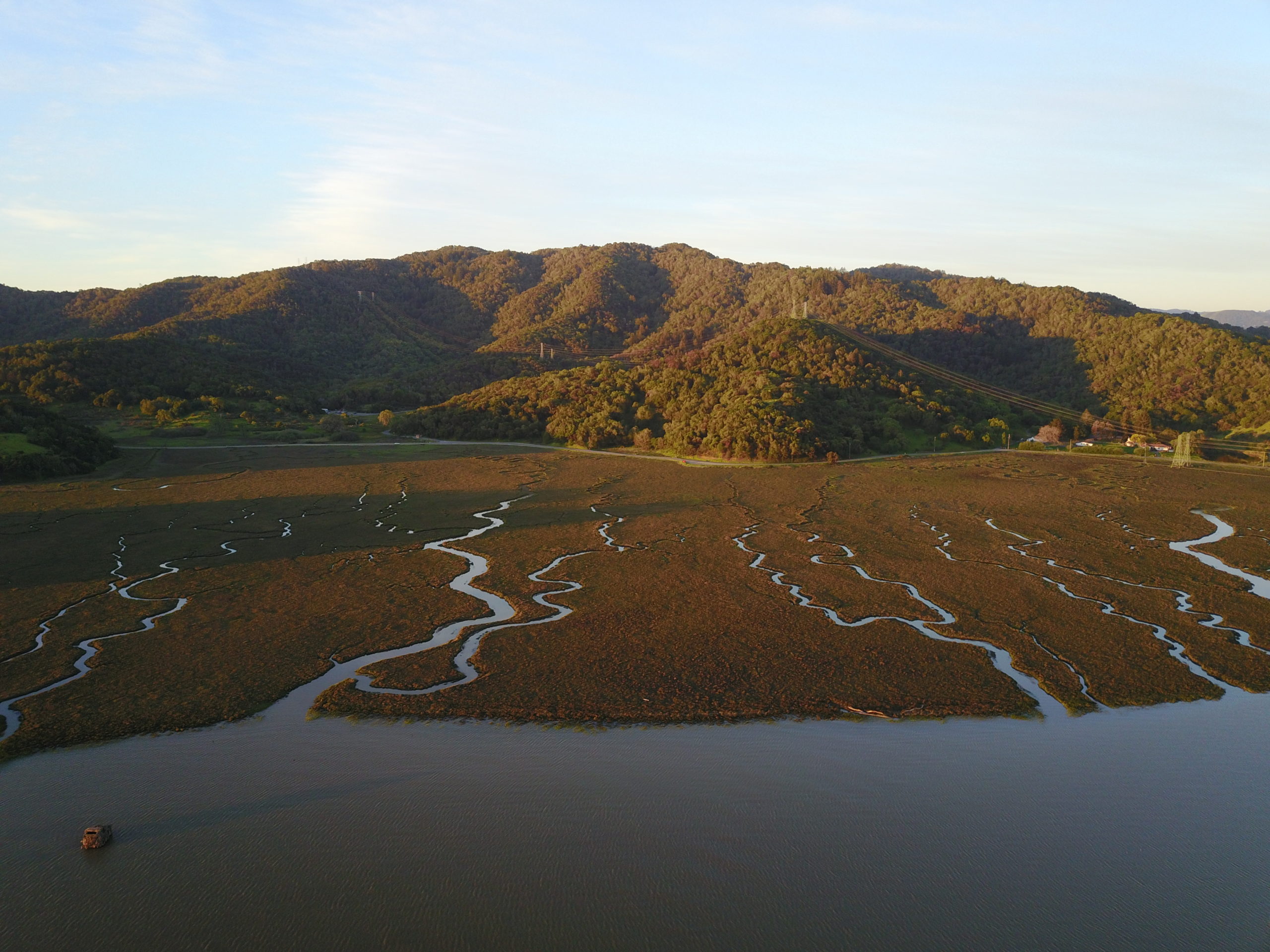
Forests and trees play a critical role in carbon sequestration while providing other benefits to communities, including improving air quality, regulating hydrological processes, reducing energy costs and promoting well-being. Accurate monitoring of these resources over time may enable communities to make better land management decisions that benefit both climate and people simultaneously.
WRI and ICLEI USA are continuing to seek input from stakeholders across the U.S. and around the world on how these methods may best be scaled across geographies, governments and technical capacities.
For questions or to learn more, reach out to erin.glen@wri.org or tom.herrod@iclei.org.
This article was originally published by the World Resources Institute.
To learn about other free and publicly available tools that help decision-makers harness the full potential of natural climate solutions, visit our Natural Climate Solutions Toolbox here.