Conserving a Way of Life: John Reed

Opportunities like conservation easements let landowners like Reed take good care of his cattle while maintaining the fencing system that protects the land from overgrazing. © Dudley Edmondson

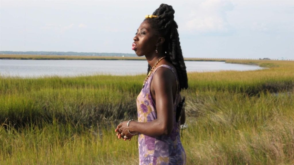
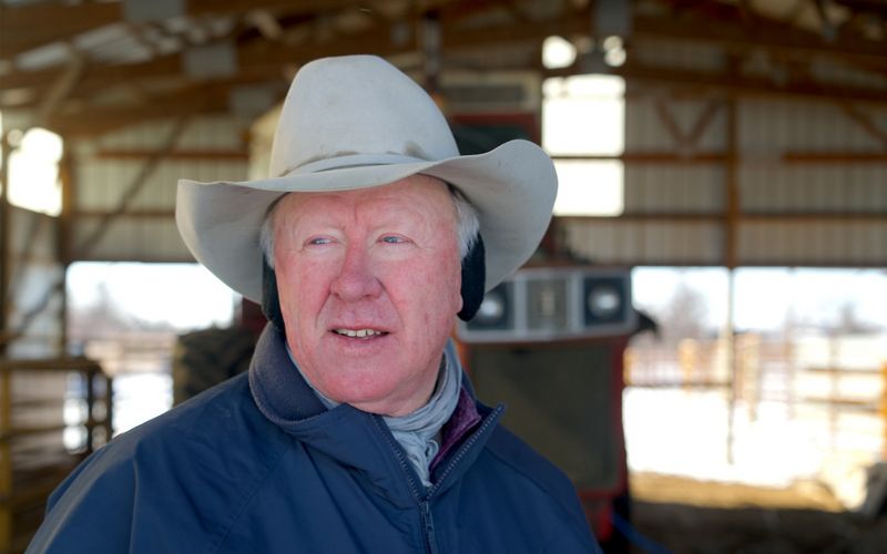
When The Nature Conservancy helped John Reed buy more land for his purebred Angus cattle operation, it fulfilled one of the rancher’s long-time dreams. 

A North Dakota native who now makes his home in the Brooten area of Minnesota, John earned his master’s degree in animal science. He runs the business with his son Jake, who has a doctorate in ruminant nutrition. 

John started out by acquiring land and raising cattle. He wanted to grow his herd and business so Jake could join him, but he confronted an obstacle that ranchers often face: cows need a lot of space. It’s difficult to find good pastureland for sale. 

“A lot of land has been plowed under. A lot of land went to corn that never should have been planted,” he says.  

Even when land is available, it’s often beyond the budget of even an established rancher. A cattle operation can’t always produce enough revenue to recover the cost of the land. Ranchers can rent land, but renting has its drawbacks too. Rental agreements are subject to renewal every few years, so a renter might lose the land if the landowner decides to lease to someone else. It can be difficult to build a herd without the certainty that you’ll have enough land to maintain it.

Nature’s Solutions to Ranching Challenges 

 Cattle require lots of land for proper grazing. On its own, a cow operation can’t always produce enough revenue to offset the cost of purchasing the land. © Dudley Edmondson

John was renting ranchland about 60 miles from his home and ranch. He was stuck: he wanted to expand the business so that it was large enough for Jake to run cattle too, but he didn’t feel comfortable renting more land and what land is available for sale is expensive. 

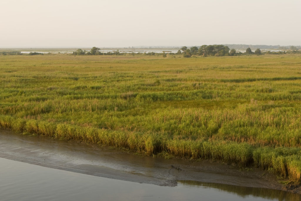
In time, a nearby property came up for sale—valuable property with native grassland and a creek. It was reasonably priced, but it was still too expensive for a cattle-only operation. But John knew that this land could be the perfect addition to his ranch, and he found a solution: a conservation easement. 

Conservation easements are legal agreements that landowners enter into with public entities or land trusts. They prohibit certain land uses, such as development, while allowing the land to be used for agricultural or other purposes. The income from selling an easement on their land allows farmers, ranchers, and other landowners to keep the land and maintain their property rights. For John, having pastureland for his herd nearby saved him time and money, and it reduced his environmental footprint because he no longer had to travel a long way to reach his property. 

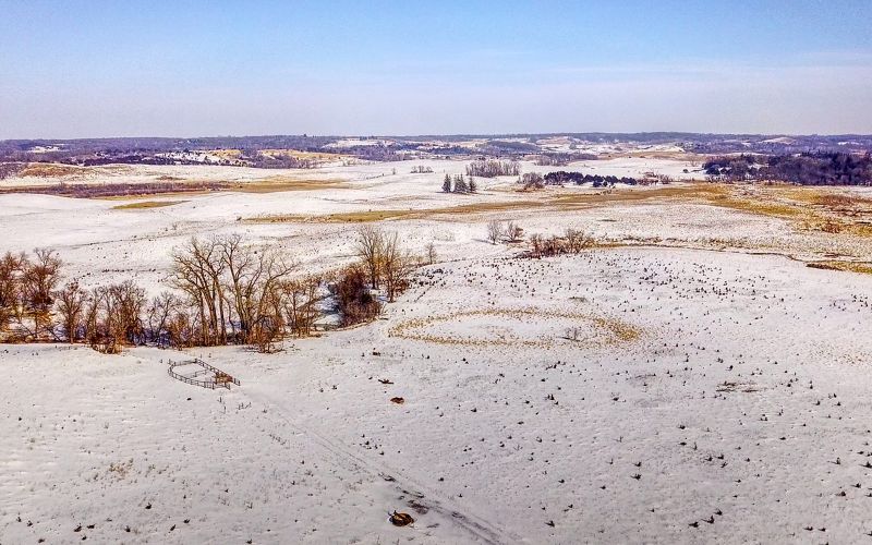
With help from The Nature Conservancy, he was able to acquire the new property in part by placing a conservation easement on the land, which is now administered by the U.S. Fish and Wildlife Service. The easement for which he was paid a portion of the value of the land, ensures that the property will remain a working grassland. The Reeds’ land, which is used for cattle grazing, has been added to the Northern Tallgrass Prairie National Wildlife Refuge. 

Conserving and Building a Family Legacy 

A lot changed for John because of the easement. “Knowing it’s there and part of the ranch, knowing we can use it forever without worrying about renting—it allows us to expand.” 

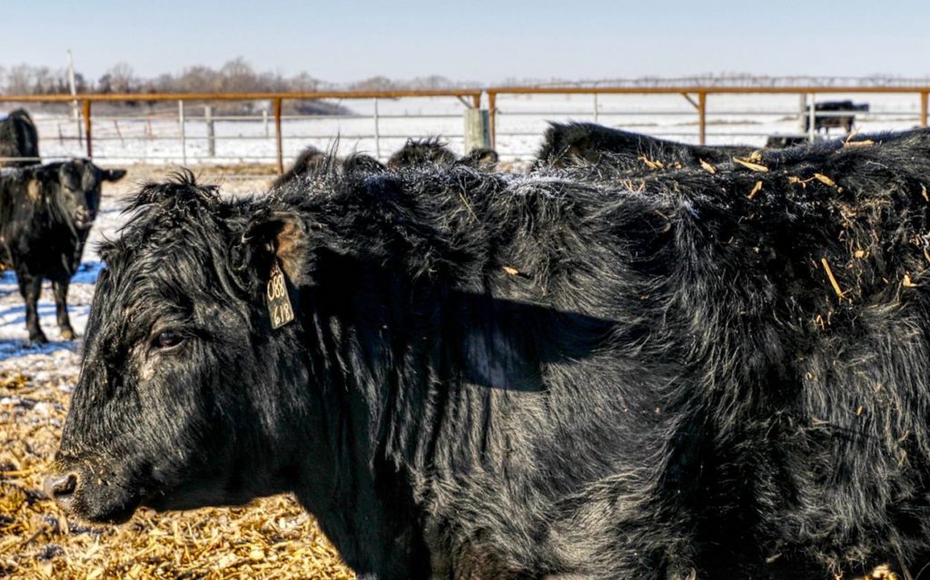
John understands that overgrazing can promote erosion, which damages the land and water. His land has loamy sand and shallow topsoil, so it can be susceptible to wind erosion if it is not managed correctly. However, the right amount of grazing can keep the land healthy. It prevents plants from becoming root bound, and cows’ presence on the land works the soil in helpful ways. John also understands the value of native prairie plants, including when they should be grazed and when they need time to recover. 

John Reed, Angus cattle rancher in Minnesota. © Dudley Edmondson

To give their land the opportunity to rest and recover, the Reeds maintain a complex fencing system that protects the land from overgrazing, keeps the creek bed from being damaged by cattle, and keeps runoff out of the creek. Over the years, John has been able to add 50 head of cattle to his business. He’s also added fencing and water lines. 

When John acquired the new property, a number of invasive plant species with poor value for wildlife were growing on it, including cedar, alfalfa, and brome. Native grasses provide better nutrition for cattle and are more tolerant of droughts. By restoring the land to native species, the Reeds can keep their feed costs down. In addition, the land stores more carbon and has more value for wildlife.  

“The land is beautiful,” John says. “There’s beauty in native grassland, and in the summer it comes alive with wildflowers including goldenrod and lady slippers. Wildlife is abundant too, especially grassland birds.” For him and his family, a conservation easement was the key to maintaining his successful livelihood and preserving this piece of grassland forever. Minnesota benefits too—grasslands protect water quality and keep carbon in the ground. 

Visit the Trees. Water. Soil. website for more stories about nature and climate solutions for Minnesota.

Land, Climate and Corazon

Photo Credit: Shana Edberg/Hispanic Access Foundation

Have you felt that life seems to make more sense when you’re out in nature? In the concrete and the polluted air of built-up neighborhoods, we feel a turmoil and pull from our obligations that melts away under the shade of trees and the clean air of the mountainside. Natural areas are a respite from our everyday lives, and increased usage of our national parks and public lands and waters during the pandemic has confirmed how badly we need it.

But nature is more than a respite for the mind, body and soul in times of stress. It is a respite from the dangers of the climate crisis, a carbon sink, and a source of clean air, water, and soil that we rely on for our basic needs. It is also a provider of local jobs and revenue and a boon to children’s education.

Unfortunately, not everyone is able to access and unlock these benefits. Nationally, communities of color are three times more likely to live somewhere that’s “nature deprived.” A nature-deprived neighborhood is one that is facing a greater rate of destruction of close-to-home natural areas and green spaces than average, be it from urban sprawl, gray infrastructure, or oil and gas development. With communities of color also more likely to be over-burdened by sources of pollution, this is a double whammy of environmental injustice.

Protecting natural areas and restoring degraded areas that are close to urban areas and communities of color is a way to help mitigate this injustice. One such example of a beautiful protected area is the San Gabriel Mountains, at the northern edge of the Los Angeles Basin, where I grew up. Los Angeles County is a large urbanized area encompassing multiple cities and millions of residents, many of whom are underserved and live in nature-deprived neighborhoods. 

Photo Credit: Shana Edberg/Hispanic Access Foundation

More than 15 million people live within 90 minutes of the San Gabriel Mountains, and the mountains provide 70 percent of Los Angeles’ green space – alleviating the Nature Gap. The mountains also provide a third of LA County’s drinking water. President Obama designated the San Gabriel Mountains National Monument in 2014, protecting LA’s water quality, improving air quality, and providing better access to outdoor recreation for millions of Angelenos while protecting the area’s ecosystems and wildlife. 

The Angeles National Forest, which encompasses the Monument, is also a key player in the Earth’s climate system. The range’s trees and chaparral absorb carbon dioxide from the air and together store 11.6 Million Metric Tons of carbon, equivalent to the emissions from 2.5 million cars for a year.

Hispanic Access Foundation works with community leaders and policymakers throughout California and the US to bring the benefits of nature to Latino communities. From the absorption of pollutants to resilience to extreme heat, droughts, and storms to the physical and mental health benefits of being outdoors, our communities need access to nature more than ever in an increasingly chaotic and warming world. 

Decision-makers in Congress, the Biden administration, and the State of California are currently considering policy that would protect more nature in California. One such example is the PUBLIC Lands Act, introduced by Senators Alex Padilla and Dianne Feinstein, which would protect and increase access to more than one million acres of public lands and over 500 miles of rivers in California, including the San Gabriel Mountains. Another policy example is Governor Newsom’s Executive Order to protect 30% of California’s lands, water, and ocean by 2030 (known as 30×30), a goal that is also reflected nationally in the Biden Administration’s America the Beautiful initiative. 

In addition, there are several areas on land and sea that have been nominated for protected area designations or that could have their protections reinstated following Trump-era orders to weaken and shrink them. These areas include the Chumash Heritage National Marine Sanctuary, important for preserving indigenous heritage off the California coast; the Western Riverside Wildlife Refuge, bringing nature access to California’s Inland Empire; Caster Range National Monument, important to Latino heritage and access to nature in El Paso, TX; the Chesapeake National Recreation Area, boosting access to nature for Latinos and communities of color surrounding the Chesapeake Bay; the restoration of Bears Ears, Grand Staircase-Escalante, and Northeast Canyons and Seamounts National Monuments; among many others.

These nature protection and restoration policies must be implemented equitably, centering the needs and voices of communities of color, in order to guarantee a safe, inclusive, pollution-free outdoors for all that addresses environmental justice, meets community needs, and confronts the urgency of the climate crisis we face.

Watch this video to learn more about the importance of protecting public lands, such as California’s San Gabriel Mountains for conservation.

Shanna Edberg is the Director of Conservation Programs at Hispanic Access Foundation.

Creating Resilient Forests in the Jemez Mountains

New Mexico’s Rio Grande and its tributaries supply water to more than half of New Mexico’s population. Photo Credit: Alan W. Eckert/The Nature Conservancy

Imagine your favorite forested area without big, beautiful pine trees cooling you from the sun or providing fresh air during your hike. That’s what New Mexicans across the Jemez Mountains faced when the region was scorched by the Las Conchas Fire in 2011. The flames burned so hot that thousands of acres were left without trees, or the seed sources for natural forest recovery. Heavy rains that followed the fire sent ash and sediment down the Rio Grande River, the pollution preventing downstream cities from withdrawing water for 40 days.

Water is life and livelihood. Nowhere is that a truer statement than in New Mexico. Each year, large and severe wildfires and post-fire flooding increasingly put our water sources at risk. State and federal agencies spend hundreds of millions of dollars each year responding to these fires. Communities affected by severe wildfire face loss of revenue to local businesses, loss of outdoor cultural opportunities. Without action, New Mexico’s future water security and nature-based culture are at significant risk.

To address this challenge, The Nature Conservancy and a broad network of stakeholders formed the Rio Grande Water Fund (RGWF) to work cooperatively to reduce the risk of megafires, protect precious water supplies and build resilience against climate change threats.

This public-private coalition of 100 signatories – including non-profits, tribes, government agencies, and businesses – are working collaboratively to scale up restoration with a goal of improving the health of 600,000 acres of New Mexico’s forested watersheds to secure water for 1 million people. The RGWF is designed to generate sustainable funding for a 20-year program of large-scale forest restoration treatments which include projects to thin overgrown forests, restore wetlands and streams, engage youth, inform policy makers with our science and generate forestry and wood products jobs.

Surprisingly, thinning forests followed by controlled burns is an important climate solution. On the surface, it seems like a way to lose precious carbon. However, it’s important to understand that fire is a natural process and has always been a part of western forests. Forests need fire to recycle nutrients, reduce competition between trees, and prepare seedbeds for the next generation. Until the early 1900’s Indigenous Peoples used fire to protect their homes, water and cultural traditions. European settlers changed the forest, bringing livestock that ate the grass that carried ground fire and removed large fire resistant trees. In the early and mid-20th century, fire was considered the enemy of forests, and most fires were suppressed, leaving a backlog of dense small, flammable trees.

Now, hotter and drier temperatures, coupled with our overcrowded forests, encourage fire behavior that is much more intense, releasing huge amounts of carbon into the air all at once. By improving the health of our forests, we’re making them more resilient, stabilizing carbon and increasing carbon capture as healthy trees continue to grow. Healthy forests absorb more carbon dioxide, storing it in large trees, helping cool our planet.

Because the Las Conchas Fire left no seed sources across thousands of acres of scorched land, The Nature Conservancy expanded the Rio Grande Water Fund work to include an innovative reforestation effort supported by many partners.

Photo Credit: Collin Haffey/The Nature Conservancy

TNC is working with research scientists to find the most drought resistant “mother trees” for seeds, grow seedlings in a way that makes them more drought hardy , then plant “tree-islands” – small clusters of trees – in the burned areas of the Jemez Mountains. These tree islands will serve as the seed sources for the future.  Using new projections of climate change impacts, and our understanding of what trees need to grow, we identify places where trees have a stronger likelihood to survive in the future. Additionally, our local Indigenous partners from the local Pueblo communities add more value to the work by sharing which tree species locations are culturally important. They also lead the planting operation.

Reducing the risk of damaging wildfires – and planting in areas where natural tree regeneration is unlikely – are forest strategies that together help maintain and increase carbon storage on the landscape. Since 2014, RGWF partners have thinned and conducted controlled burns on nearly 150,000 acres to prevent catastrophic wildfires, while planting in tandem to capture carbon, protect water, and create wildlife habitat.

One reason for the RGWF’s success is its collaboration across boundaries and between organizations working at all scales.  The USDA Forest Service, the New Mexico Dept. of Game and Fish and the Water Utility Authority for Albuquerque and Bernalillo County are some of our larger Water Fund partners. At a more local scale, we work with the Cerro Negro Forest Council, a collaborative of people from traditional Hispanic villages near Taos, New Mexico. Members thin forest plots to reduce fire risk, and then can sell the wood they produce to provide income for their families. The project is managed by a local “Mayordomo”, a governance system modeled on the centuries-old irrigation management system used by these communities.

Through cooperative and coordinated burning we are able to burn more acres with prescribed fire due to safe staffing levels. Here the All Hands All Lands Burn Team organizes representatives from 12 different organizations. Photo Credit: Collin Haffey/The Nature Conservancy

Part of the challenge of large-scale work to mitigate climate impacts is having enough people available and trained to do the needed work. The Rio Grande Water Fund supports the “All Hands All Lands” (AHAL) controlled burning program that builds capacity of forestry workers to use fire well and uses a cooperative burning projects to put more good fire on the ground. Federal fire workers that we depend on to do the burning need to make forests resilient are often called on to fight fires outside New Mexico. Engaging more skilled people to put good fire on the ground is way to help everyone make progress. According to Dave Lasky, the Forest Stewards Guild leader who manages the AHAL Burn Team, “The goal of the AHAL is to get ahead of prescribed fire backlogs on federal, state and tribal lands and support private landowner’s use of prescribed fire.”

Healthy forests lead to healthy livelihoods. Vibrant, resilient forests protect our water, provide wildlife habitat, support the state’s outdoor recreation and forest products economy. Even more importantly – as climate change bears down – healthy forests can store more carbon dioxide to help cool our planet and improve our quality of life.

Portions of this article were adapted from The Rio Grande Water Fund’s 2020 Annual Report

For more information, read about the Rio Grande Water Fund at their website and at Nature.Org.

Anne Bradley is the Forest Program Director at The Nature Conservancy in New Mexico. 

Forests: A seemingly simple answer to confronting climate change and biodiversity loss

Nearly every day we’re surrounded by negative news about the accelerating rates of climate change and biodiversity loss.

Today, however, we not only have good news about a path to confronting those twin crises, but we also have a tangible tool to help us navigate that path towards success.

In one sense, it’s a surprisingly simple path – a path of forests.

We’ve always known that forests are a critical part of the climate solution, removing climate-changing carbon dioxide from the atmosphere and storing it in their trunks, branches, and roots. When forests are destroyed, that stored carbon not only gets released back into the atmosphere, but the potential for those forests to remove carbon dioxide in future years also disappears. When we lose forests, we lose their climate-protecting powers, forever.

Until now, there was scant data to determine just how much potential for carbon sequestration was lost from deforestation, particularly on small scales at state and municipal levels. And without this data, government agencies, conservation groups, and others lacked information about the value of protecting different lands for carbon sequestration.

The good news is we now have a tool that can provide that data.

Scientists with The Nature Conservancy and Clark University in Massachusetts have worked together to create a forest carbon analysis and online mapping tool that shows the potential of forests across the continental US to capture and store climate-changing carbon emissions for years to come, even on lands as small as one-quarter of an acre.

The carbon potential numbers identified in the analysis are meant to serve as baselines that land managers can use to determine how future actions and disturbances on forests will affect actual carbon sequestration. For example, many forests particularly in the Western US will fall short of their carbon potential because of wildfire or other disturbances. Conversely, ecological thinning and removing competing vegetation can help forests reach their full carbon storage potential.

Numerous states along the East Coast have already heralded the importance of having this data, saying it will help them prioritize landscapes for conservation, improve greenhouse gas accounting, identify opportunities for small landowners to participate in emerging carbon markets, and calculate how forest protection compares to other, sometimes more costly, means of removing and reducing carbon emissions.

Adding to this good news is the fact that the mapping tool shows that many of the forests with the highest potential to capture and store carbon into the future are also among the most important places for diverse species to find refuge from climate impacts.

These carbon “hotspots” are part of a network of lands that have been identified by The Nature Conservancy as having unique geological and topographical features – such as ravines, steep slopes, and diverse soil types – that create “microclimates” where species can find safe places to live as their habitats are altered or destroyed by climate impacts.

We can now identify forests we can’t afford to lose if we want to tackle climate change and the loss of biodiversity. This could be a game changer.

Lands along the Appalachian Mountains and the Pacific Northwest – including Washington state’s Hoh River, the Altamaha River corridor in Georgia, and the Cumberland Forests that span Kentucky, Tennessee, and Virginia – are among the lands that have been identified to have both high potential for carbon sequestration over the next 30 years, while also providing diverse plant and animal species refuge from floods, drought, and other threats of climate change.

To be sure, forest conservation alone will not stop climate change. The climate emergency requires myriad solutions. We need to dramatically transform the global economy to reduce emissions from all sectors, including energy, transportation, manufacturing, construction, and land use.

Science led by The Nature Conservancy has shown that natural climate solutions – such as conserving forests, improving soil health, protecting grasslands, and restoring coastal wetlands – are an important part of the solution and have the potential to remove 21% of the America’s carbon pollution.

Unfortunately, nearly 1 million acres of forest lands are lost across the continental US each year due to development and other uses. That is equivalent to losing more than 100 acres of forests each hour and, with them, decades of stored carbon as well as their future ability to store more.

This new mapping tool can provide the data we need to stop this trend and allow us to clearly quantify how we can confront two of the greatest threats facing the world today – climate change and biodiversity loss—by taking one seemingly simple yet powerful step: keep our forests as forests.

Dr. Mark Anderson is the Director of The Nature Conservancy’s Center for Resilient Conservation Science.

Climate Resilient Conservation on Atlanta’s West Side

Photo courtesy of HDR 2021 Paul Dingman

When many of us think of conservation and Natural Climate Solutions, cities may not be the first places that come to mind. We might imagine vast spaces like national parks, forest preserves, or coastal ecosystems. But conservation is not only the preservation of wilderness – it can also integrate into urban areas through city parks and thoughtful planning of the entire urban landscape. For some communities where green spaces are common, this comes as no surprise. But many neighborhoods, particularly communities of color, lack the benefits of a nearby greenspace. People of color are three times as likely to live somewhere that is nature-deprived than predominantly white communities. This “nature gap” leads to disproportionate health and economic impacts due to poor air quality, urban heat islands, limited exercise and recreation opportunities, and greater risks from severe weather. 

Cities around the United States are addressing this equity issue by listening at the local level, and the Trust for Public Land is helping communities plan for urban green spaces that provide numerous social, environmental, and climate benefits. One such example of urban conservation has taken place in the middle of west Atlanta’s historic Vine City neighborhood. The area has long been home to African American luminaries like Dr. Martin Luther King Jr. It sits adjacent to the nation’s oldest and largest association of historically Black colleges. It’s also been a “center of gravity for activism and leadership during the civil rights movement of the 1950s and 1960s,” and has been a “home for generations of Black scholars, business owners, and activists.”  

The neighborhood is also in a lower-lying area where Proctor Creek once flowed before it was channelized and buried in the early 1900s. As development expanded, naturally absorbent lands were replaced with pavement and other impervious surfaces that send stormwater into an already stretched stormwater system. All of these factors combined to put the neighborhood at increased risk for flooding during storms. In September 2002, days of heavy rainfall overwhelmed the sewer system and flooded hundreds of homes, many of which became uninhabitable. The cost of rebuilding the homes – and risks of a repeat flooding incident – were deemed too great, and city leaders decided to relocate residents and raze more than 60 properties.  

Photo Credit: Alex Jackson/The Trust for Public Land

The Trust for Public Land partnered with the City of Atlanta, the local community, and a network of generous donors, innovative consultants, and experienced contractors to create a space that will make the site and the surrounding community more resilient as storm events continue to become more significant and frequent. This was accomplished by creating a dynamic park that has the ability to collect and manage 9 million gallons of stormwater from the 160 acres adjacent to the site using innovative green infrastructure solutions. Without the park and its specialized green infrastructure, flooding would have continued to wreak havoc on this neighborhood.

This summer, the neighborhood completed this transformation from tragedy to triumph, as Vine City celebrated the opening of Cook Park. It is now a “gleaming new space of trees sprouting and gardens of native grasses and plants filling in their beds. Walking paths wind past new playground and exercise equipment centering a two-acre pond ringed with wildlife-friendly wetlands.”   

As with any successful conservation initiative, this project relied on partnerships and community engagement. The opportunity to work with Vine City and English Avenue residents, helping address these topics through the creation of a best-in-class park is a perfect example of how the process can be as important as the outcome. Through community festivals, neighborhood association and church gatherings and formal presentations, residents became vital partners to The Trust for Public Land and the City of Atlanta as we strived together to create a space that, in addition to reducing the risk of dangerous flooding, inspires physical activity, calms nerves and draws people together. 

Photo courtesy of HDR 2021 Paul Dingman

We are excited that the design, planning, and construction of the park positioned it well to become a center-point for outcome-based, health-focused recreation services and planned fitness programming when it finally opened. Over the project’s six-year lifespan so far, we have partnered with a number of small, neighborhood-based or neighborhood-focused organizations to provide health-centric programming. Urban Perform, the Arthur M. Blank YMCA, and Chris 180, to name a few, are poised to use climbing boulders, sport courts, and fitness equipment as soon as social distancing restrictions are lifted. The relationships we have formed with neighborhood groups and individual residents have allowed a more efficient and inclusive transition from design to construction to stewardship.  

Lastly, while not the primary goal, the park can also help mitigate climate change by planting trees. Research by University College London has shown that urban forests can store nearly as much carbon per hectare as tropical rainforests. In the U.S., the top 100 largest U.S. cities alone contain approximately 2 million acres of city park space; collectively these conservation efforts add up to make a big difference. And with Cook Park, Atlanta is one step closer to its goal of putting a great park within a 10-minute walk of every resident. 

For more information on Cook Park and the Trust for Public Land:  

Large Landscape Conservation: Pine Mountain Wildlands Corridor

Pine Mountain – Bad Branch – © Scott Hotaling

Conservation of large intact landscapes is essential to protecting biodiversity and maintaining ecosystem functions and resilience. “When we look at protecting high biodiversity regions within landscapes that are considered to be climate resilient, there’s an opportunity to take local action that really transcends to global significance,” says Greg Abernathy of the Kentucky Natural Lands Trust (KNLT). Through the Pine Mountain Wildlands Corridor, KNLT is working to connect existing protected areas along Pine Mountain to form a 125-mile contiguous forested migratory corridor in Central Appalachia from Virginia through Kentucky to Tennessee. The project is part a larger continental scale conservation effort known as the Eastern Wildway.

Large forest tracts are important to safeguarding plant and animal populations and are vital to the overall health of the forest itself. Healthy protected forests serve as natural carbon sinks, storing huge amounts of carbon and keeping it out of the atmosphere. The U.S. Forest Service has found that, on average, American forests store 158,000 pounds per acre of carbon (above and belowground), and each tree continues to sequester additional carbon annually throughout its lifespan. With 180,000 total acres in the Pine Mountain Wildlands Corridor, the EPA’s Greenhouse Gas Equivalencies Calculator estimates that this area alone accounts for the emissions from more than 1.7 million homes for one year. 

Central Appalachia, including Pine Mountain, is a region considered to be one of the most biologically diverse temperate zone forests on the entire planet. This biodiverse forest is home to thousands of species of plants and animals, species that are foundational to the life support system on planet Earth. The region is also considered to be climate resilient – thus the ecosystems, plants and animals found here are better positioned to adapt and persist in the face of climate change. The forests of this region are a globally significant carbon sink, and their protection is critical to addressing the climate crisis.

American black bear – © Marc Evans, KNLT

Central Appalachia has a history of extensive resource extraction, including limestone and coal mining, logging, and natural gas drilling. Forest conversion and fragmentation resulting from these activities impacts overall ecosystem health. The region is also undergoing a generational shift in landowners that is further fragmenting the ownership of these wild places making conservation much more complex. Although free of merchantable coal, extraction remains a threat to Pine Mountain, however, conservation and the resulting public lands are becoming a valued asset as the region transitions to a more diversified and sustainable economy.

Large landscape conservation depends on the power of partnership. Through a public-private partnership, KNLT and its conservation partners have protected over 69,000 acres — nearly 40% of Pine Mountain. The result is a matrix of conservation lands that protect vital habitat and headwater streams while providing outdoor recreation opportunities. The primary conservation tool used on Pine Mountain is direct purchase of land from willing sellers. Acquisition and protection of these wildlands is only possible with funding which has come from a mixture of private philanthropy, foundations, government agencies and mitigation funds. 

Science-driven and Community-minded Conservation

Pine Mountain – Blanton Forest – © Gerry James, Explore Kentucky Initiative

Pine Mountain Wildlands Corridor project is a great example of KNLT’s science-driven and community-minded conservation. The project serves as a natural climate solution that mitigates both local and regional climate threats while providing additional environmental, social, and economic benefits, all of which are foundational to the pillars that drive KNLT’s work:

Biodiversity: The foundation of life on the Planet is dependent upon intact ecologically functioning natural systems. Pine Mountain has some of the most biodiverse forests in the state and is within Central Appalachia, home to one of the most biodiverse temperate zone forests on Earth. These forests are vital carbon sinks.

Climate Resilience: Central Appalachia, including Pine Mountain, is a geography with an extremely varied landscape that is considered to be climate resilient. The plants, animals and intact natural systems found here are better positioned to adapt and persist in the face of climate change.

Just Transition: Protected wild places are important to cultural, human, and economic health. Conservation lands foster outdoor recreation, tourism, and livability for local communities. Wildlands are vital to communities undergoing economic transition, like what is unfolding throughout Central Appalachia.

Watch this video from Kentucky Natural Lands Trust on Biodiversity and Climate Resilience to learn more.

Kentucky Natural Lands Trust is a nationally accredited nonprofit that has protected over 50,000 acres of wildlands from the mountains of Eastern Kentucky to the sloughs of Western Kentucky. Learn more by visiting: www.KNLT.org

Conservation is Climate Action

Photo Credit: Preston Keres/USDA

For a challenge as great as climate change, there are no silver bullets. Right now, much of the conversation on solutions focuses on curbing greenhouse gas emissions through investment in renewable energy, electric vehicles, and low-carbon construction. These are vital strategies for addressing climate change, but the critical role conservation of natural and working lands plays in mitigating climate change is often left out of this discussion.

There are many benefits associated with land and water conservation. Taking action to protect and restore our forests, grasslands and coastal wetlands provides habitat for wildlife, improves water quality, and makes communities more resilient to extreme weather and storm events – all while creating jobs. At the same time, conservation is an important climate change strategy. Forests, grasslands and coastal wetlands draw in and store carbon from the atmosphere. Conservation actions can increase how much these ecosystems take in and prevent the carbon they already store from being released.

U.S. Nature4Climate is highlighting conservation success stories that illustrate how conservation action is climate action. Conservation is a climate strategy that can take place everywhere – from America’s vast sagebrush steppe to New England’s lush forests. We will highlight the benefits of conserving coastal ecosystems, like salt marshes and forested tidal wetlands. These “blue carbon” ecosystems have the potential to store up to 25 million tons of carbon dioxide a year, while also providing habitat for fish and other marine species, stabilizing shorelines, and supporting recreational and commercial fishing.

Additions to and sustainable management of America’s national parks, forests, monuments, and wildlife refuges are a key part of our conservation and climate action story too. For instance, the Angeles National Forests provides clean water, access to nature, and jobs. At the same time, the area’s shrublands and forests store carbon equivalent to taking 2.5 million cars off the road for a year .

We will also recognize the important role that private landowners can play in our efforts to conserve lands and waters. Farmers and ranchers who sustainably manage their lands provide habitat for wildlife and sequester carbon. For example, rancher John Reed worked with The Nature Conservancy and the U.S. Fish and Wildlife Service to place a conservation easement on his land – protecting important native grassland from development.

We will highlight the leadership provided by Indigenous communities in actualizing the climate benefits of conservation action. For example, the Confederated Salish and Kootenai Tribes of the Flathead Nation implemented a climate change strategy on reservation land that helps protect ecologically important whitebark pine trees. In addition to capturing carbon, these trees provide food sources for grizzly bears and help protect water supplies to surrounding communities. Through a combination of tree planting and controlled burns, the Salish and Kootenai Tribes are helping whitebark pines survive and thrive.

Even urban parks have a role to play and can sequester nearly as much carbon per acre as tropical rainforests. Any individual park’s impact may be small, but with more than 20,000 city parks nationwide, the collective benefits add up. Meanwhile, innovative conservation projects – like Atlanta’s recently completed Cook Park – support urban infrastructure to manage water during storm surges, provide shade to cool urban heat islands, and ensure more equitable access to nature and recreation for millions of people

So yes, conservation is climate action.

Please visit our new Conservation IS Climate Action campaign page, and the U.S. Nature4Climate blog to learn more about the powerful role conservation can play in addressing climate change.

Andy Jackson is a Research & Communications Fellow at U.S. Nature4Climate.

Salt Marsh Conservation on the Atlantic Coast – Where Blue Carbon Supports Diverse Partnership

Queen Quet gazes into the marsh surrounding her hometown of St. Helena Island in South Carolina. Photo Credit: Kumar L. Goodwine-Kennedy Geechee Sea Island Coalition

Between land and sea lie the ecological guardians of the coast—salt marshes. 

Their grassy and sinuous channels fill and drain with saltwater as the tides ebb and flow, providing food, shelter, and nursery grounds for birds, fish, and other wildlife, ranging from dolphins and otters to snails and turtles.  

Healthy salt marshes cleanse the water by filtering runoff, and help other ecosystems, including oyster reefs and seagrass beds, thrive. And conserving salt marsh helps people, too. Marshes can reduce erosion, stabilize shorelines, and protect against storm surge. Together with other coastal wetlands, these ecosystems provide the equivalent of $23.2 billion in storm damage protection per year. Species that are crucial to recreational and commercial fishing, hunting, birding, and other activities rely on this important habitat as well.

Salt marsh plays a less obvious, but major role in helping moderate the effects of climate change. These grassy expanses sequester and store carbon at a rate 10 times that of mature tropical forests. If left undisturbed, the carbon captured and retained by ocean and coastal ecosystems – collectively known as blue carbon – can remain stored for centuries to millennia.

Conservation and protection of salt marshes and adjacent lands is important to maintaining shorelines, protecting communities, keeping marine ecosystems healthy, and helping coastal economies thrive. Communities can and should work together to develop plans that restore, protect, and allow these vital habitats to adapt to changing environmental conditions. It’s also critical for such programs to engage local stakeholders and support frontline communities that experience disproportionate social and economic impacts from the climate crisis.

Among those working to protect salt marsh are the Gullah/Geechee – descendants of enslaved Africans who have worked together for generations to protect their lands, waters, history, and culture. These estimated 1 million people inhabit the Sea Islands and coastal areas stretching from Jacksonville, North Carolina, to Jacksonville, Florida, and 35 miles inland. Since the times of slavery, the Gullah/Geechee people, who hail from numerous African ethnic groups and built some of the richest plantations in the South, were informally considered “a nation within a nation” with their own language, crafts, and traditions. 

In 2000, members of the Gullah/Geechee community formally established their nation and chose computer scientist and South Carolina native Marquetta L. Goodwine as chieftess and head of state. Known as Queen Quet, she has gained worldwide recognition for her community and worked to protect its lands and waters. Now she’s joining a major new project aimed at conserving salt marsh—the grasslands that flood and drain with the tides and provide vital habitat for wildlife ranging from fish to birds. 

Photo credit: Erika Nortemann/TNC

The project, known as the South Atlantic Salt Marsh Initiative, was initiated by The Pew Charitable Trusts and formally launched in May with the support of the Southeast Regional Partnership for Planning and Sustainability. This work brings together federal, state, and local governments, military officials, and community leaders such as Queen Quet, who recognize the habitat’s ability to help protect shorelines against flooding and storm surge. The initiative aims to conserve about a million acres of marsh stretching from North Carolina to north Florida, an area that is home to installations for every branch of the military.  

In the coming months, initiative leaders will begin hashing out a plan designed to help communities and the military better prepare for the future through coordinated transportation and development plans, targeted restoration projects, and conservation of lands adjacent to marshes, allowing the tidal wetlands to move as sea levels rise. 

This interview with Queen Quet, originally conducted by The Pew Charitable Trusts, has been edited for clarity and length.

Q: Why is salt marsh important to the Gullah/Geechee people? 

A: The waterways are sacred to us and provide our food. Every native Gullah/Geechee grew up breathing in the smell of pluff mud as we proceeded out to get the family meals of fish, shrimp, oysters, clams, and blue crabs. In the soil we grow staples of the Gullah/Geechee diet, including rice and vegetables. The salt marsh is not something that we simply go through or to; it’s part of our family, too. Our lives depend on it.

Q: What are your biggest concerns for the habitat? 

A: We’ve seen this area change over the decades as the ocean acidifies, bridges are built, newcomers arrive, and overbuilding infringes on our islands and salt marsh. The pilings used to invade the salt marsh with private docks feel like stakes being hammered into the heart of those of us from this coastline, because de land da we famlee and de wata da we bloodline (the land is our family and the water is our bloodline).

Q: What changes are you seeing in the salt marsh? 

A: The continued negative impacts to our coastline due to climate change have caused visible harm to the salt marsh to the extent that we had to begin replanting the spartina grass (the main vegetation found in salt marsh) when we replant oyster shells to create new oyster beds. Combating sea level rise and protecting the maritime forest from eroding are some of the ecological and environmental sustainability actions that the Gullah/Geechee Sea Island Coalition and the Gullah/Geechee Fishing Association have been a part of for decades. Initially, the rapid erosion we saw appeared to be connected to flash floods and hurricanes, but over time, we had to learn terms that do not exist in the Gullah language—such as “sea level rise.”

Q: What would happen to your nation if you lost significant portions of salt marsh habitat? 

A: The loss of the salt marsh would be the death of the fisheries that I grew up traversing with my family via the bateau (flat-bottom wooden boats) that we make traditionally by hand. It would be the erasure of the memories of seeing these sacred and spiritually rejuvenating spaces. Without being able to nourish our souls and our bodies via the waterways and estuaries that are our salt marsh areas, Gullah/Geechee people wouldn’t thrive and our culture wouldn’t survive. So the life of the salt marsh is inextricably tied to our cultural continuation.

Q: How do the Gullah/Geechee people want to see salt marsh conserved? 

A: The Gullah/Geechee Nation created a sustainability plan in 2010 that includes a special ocean action section. We’re expanding the plan to include a specific section on the salt marsh, as we enter into new initiatives to prevent litter and debris from entering the area and as we work to educate people more about the life that exists between what to many simply look like blades of grass covered by water a few times a day. We’re proud to work with global partners via the United Nations to protect our environment and continue our cultural heritage. 

Q: Can you say more about this work with the United Nations? 

A: We’re working on the United Nations sustainable development goals and due to that effort, we’ve been supporting the United States’ and South Carolina’s 30 by 30 plans to conserve 30% of the waterways and 30% of the land by the year 2030. We would want special emphasis to be placed on the salt marsh and the ocean in the implementation aspects of these plans. That would allow the salt marsh to not only be conserved but would allow it to naturally be replenished.

Q: What do you hope for the new South Atlantic Salt Marsh Initiative?

A: The initiative is a perfect fit for the Gullah/Geechee Nation! It suits us like a custom-made garment or a personally crafted vessel that will finally allow us to get other folks to navigate our coast with us in a way that is in harmony with our cultural traditions. I’m looking forward to bringing Gullah/Geechee traditional knowledge into the planning process, but even more than that, I’m looking forward to putting on my hip boots and stepping out into the marsh with my Gullah/Geechee famlee.  

As one of our Gullah/Geechee proverbs goes, “De wata bring we and de wata gwine tek we bak” (“The water brings to us and the water will take us back”). I pray that this initiative allows us to take the salt marsh back to being healthy while also educating the next generation of Gullah/Geechee coastal stewards to continue the effort in the future. We intend to have many more generations of our people along this shore just beyond the marsh who will continue to walk to the shoreline to nourish their bodies, minds, and souls. Tenk GAWD fa de Gullah/Geechee coast!

Sources:

To learn more about Pew Charitable Trusts work with the South Atlantic Salt Marsh Initiative, visit:

https://www.pewtrusts.org/en/research-and-analysis/articles/2021/03/01/11-facts-about-salt-marshes-and-why-we-need-to-protect-them

https://www.pewtrusts.org/en/research-and-analysis/articles/2021/07/12/african-descendants-have-stake-in-saving-us-southeast-salt-marshes

https://www.pewtrusts.org/en/research-and-analysis/articles/2021/04/28/along-southeast-coast-plan-to-protect-1-million-acres-of-salt-marsh-draws-broad-support

Conserving and Restoring Whitebark Pine

Whitebark Pine. Photo Credit: Quinn Lowrey

Whitebark pine is a scraggly tree that few people ever see, given that it only grows upwards of 6,000 feet. But it is one of the most important tree species in the western United States. Grizzly bears, for example, fill up almost exclusively on whitebark pine seeds before going into hibernation. High-elevation trees and plants can’t grow to full size unless there are whitebark pines nearby to block the wind. And the water supply for people in the western U.S. is dependent, in part, on whitebark pine.

Given the value of this tree species, it’s troubling to know there are more dead whitebark pine trees than live ones in this country, according to the U.S. Forest Service. There are so few left that whitebark pine is a candidate species under the U.S. Endangered Species Act and is listed as endangered in Canada. 

Many of the forests where the trees once grew are referred to as “ghost forests,” given the large number of standing dead trees.

They have fallen victim to a non-native fungus, white pine blister rust, that prevents the flow of nutrients within the tree. They also have been hit hard by climate change, which has brought longer periods of dry, warm weather — ideal conditions for intense wildfires and an insect, mountain pine beetle, that attacks mature whitebark pines. Under normal conditions, this tree would live for more than 200 years. Some have lived for more than 1,000 years.

Nowhere is the plight of whitebark pine more evident than the Crown of the Continent, the18 million-acre mountainous region that spans northern Montana, as well as Canada’s southern Alberta and British Columbia provinces, and includes Glacier National Park. Only one in 10 whitebark pine trees in this region is untouched by blister rust.

There are five other “Hi5” tree species — so named because they only grow at high elevations and their needles are attached to branches in groups of five — in the western U.S. that are in decline. But whitebark pine is in the most danger and is the canary in the coal mine for other Hi5s.

Brian Kittler of American Forests and healthy whitebark pine on the Whitefish Mountain Resort. Photo Credit: Jenny Nichols/American Forests

The first-ever whitebark pine restoration plan for the Crown of the Continent is in the final stage of development and already has buy-in from a diverse group that includes tribal members, skiers, federal and state agencies, conservationists (including US Nature4Climate member American Forests), academics and others. The plan will prioritize what parts of the forest need to be restored and the climate-smart practices we need to use to restore them.

A key partner in this undertaking is northern Montana’s Whitefish Mountain Resort, one of the top-rated ski resorts in the country and a popular spot for hiking and mountain biking in the warmer months. The resort might seem like an unusual bedfellow for an endangered forest, but it’s a perfect fit. Scientists, conservationists, U.S Forest Service staff and others use the resort’s chair lifts in the winter to get to the top of the mountain, where they then ski to stands of whitebark pine trees to do their work. In the warmer months, the backcountry roads and trails managed by the resort make it easier for them to drive into the forests. 

In 2016, Whitefish was the first resort in the country to become certified by the Whitebark Pine Ecosystem Foundation as a whitebark pine-friendly ski resort. It was recognized for how it helps the U.S. Forest Service and others, as well as what it does to educate the general public about whitebark pine.

“The chairlift is a great opportunity to teach people about whitebark pine,” says former resort Public Relations Manager Riley Polumbus. “They can see it when we are riding up the lift together.”

Skiers enjoy the abundant snows that the whitebark pine forest helps to retain. The Whitefish Mountain Resort works with the U.S. Forest Service on whitebark pine restoration. Photo Credit: Morgan Heim/American Forests

What many people are interested in learning, after hearing about the dire circumstances this tree species faces, is what this means for them. Without whitebark, skiers would be more likely to get lost when skiing in foggy conditions, as whitebark pines — one of the few trees at high elevations — help guide the way. And they would be less likely to quench their thirst, given that whitebark pine holds snow in place in the winter (thanks to its candelabra-shaped wide crown that provides shade, which slows snowmelt) and gradually releases it into rivers in the warmer months. The river water eventually becomes drinking water.

The Confederated Salish and Kootenai Tribes of the Flathead Nation also is a key player. It manages the 1.3 million-acre Flathead Indian Reservation — 10 percent of which is whitebark pine forest.

The tribal members’ deep and centuries-old connection to the land is what motivates them to invest time and money in caring for the forest.

The tribe created a forest management plan in the 1990s that includes goals for whitebark pine. They have been following the plan ever since it was approved in 2000. But the true relevance and urgency behind the plan did not become apparent until 2013, when people on the reservation started to visibly notice changes in the forest, many of which they attributed to climate change. For example, trees that typically grew at low elevations were moving up the mountain, to cooler climates, where they were outcompeting trees that were already there.

That’s when they decided to create a climate change strategy to supplement the forest management plan.

James Lozeau is part of the team working to restore whitebark pine at the Flathead Reservation in Montana. He stores seeds harvested in the mountains of the Flathead reservation.
Photo Credit: Morgan Heim/American Forests.

The strategy incorporates forestry practices similar to those being used by the U.S. Forest Service, such as caging cones on “plus trees.” Tribal members have collected thousands of seeds from the cones they have caged in the last few years and have already planted more than 2,000 trees from those seeds on 9 acres.

But their work goes beyond planting trees, an approach American Forests refers to as “carbon offense” because the new trees capture carbon. They also play “carbon defense” to prevent forests from degrading and, then, releasing carbon when large and intense wildfires, as well as other events, occur.

For this tribe, the best carbon defense play is purposefully setting fires — called controlled burns — that eliminate trees that naturally would not be in a certain part of the forest. For whitebark pine, a tree that does not grow well in shade, that means removing other types of trees that block the sun. The fires, which are low intensity and only at ground level, also prevent a build-up of vegetation that is essentially fuel for what can become an out of control and intense wildfire.

Controlled burns were common on the reservation until 100 or so years ago, when fire got a bad name and, therefore, suppressing fires became the norm.

“Our elders have been telling us for years to stop putting out fires,” says Tony Incashola, Jr., who oversees the tribe’s forestry agency. “Fire is natural. Back in the day, people did not have tools. Fire was their only tool for managing forests. People knew how to burn, what to burn and when to burn.”

It is forward-thinking forest restoration like this from tribes and companies – as well as others – that will help ensure whitebark pine can provide benefits to people and wildlife well into the future.

Jill Schwartz is the Vice President of Marketing and Communications at American Forests.